Lassen Volcanic National Park
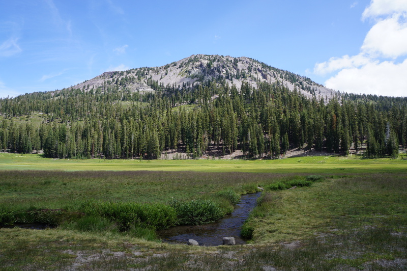
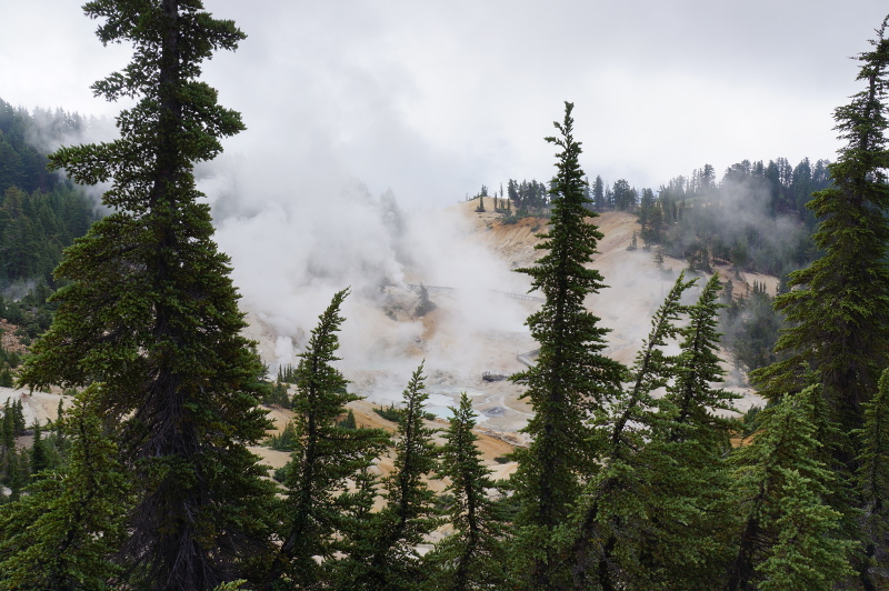
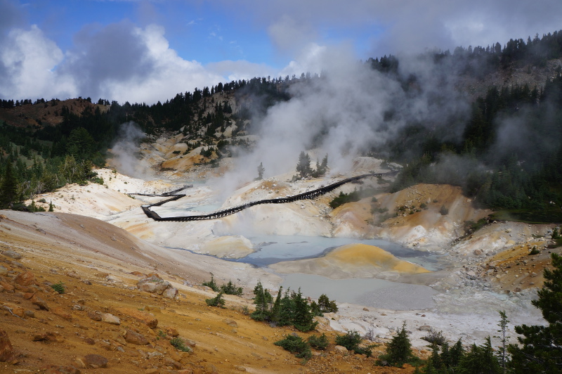
Greetings from Lassen Volcanic National Park. Lassen is located in north east California and contains the southern most volcano that makes up the Cascade Range of volcanoes. It is sort of like a super tiny version of Yellowstone in some ways. There’s geothermal areas with hot springs, mud pots and fumaroles. Completed with the smell of sulphur wafting through the air at points. The park apparently is also one of the few places where all four different types of volcanos can be found.
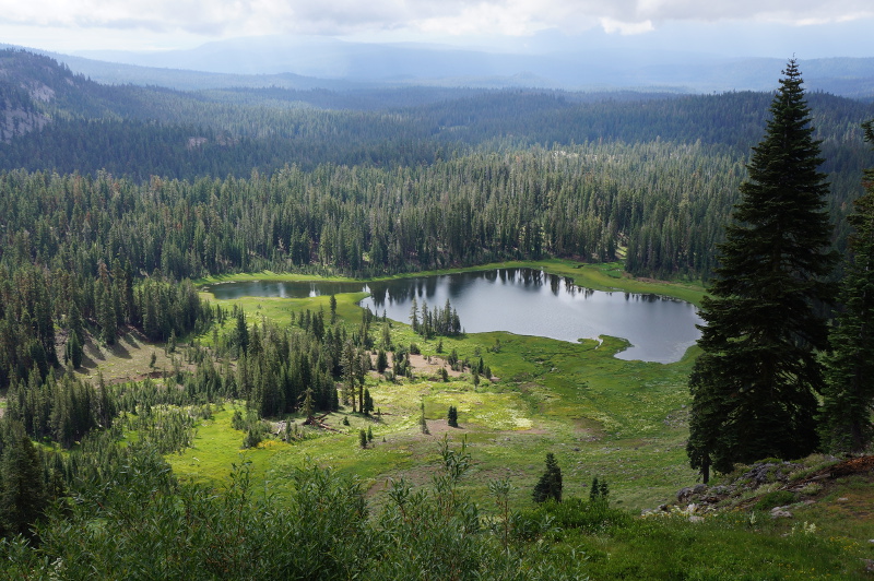
The park for the most part is fairly remote, it’s been about 1.5 hours of driving each way to get in/out of where we want to walk. One of the walks we did was called Bumpass Hell (yep another somewhat intriguing name that got my attention). It’s called Bumpass Hell after K.V. Bumpass an early settler in the area. He found the area and whilst showing it around fell through the earths crust burning his leg. As the Bumpass Hell trail wasn’t that long we continued on down to Cold Boiling Lake. Cold Boiling Lake sounded interesting as it’s named what it is due to it being a cold lake that looks boiling due to escaping carbon dioxide. In reality though it didn’t look like it was ‘boiling’ as bubbles only rose from certain areas and rather slowly at that. It did look pretty though as it was surrounded by a meadowy looking area.
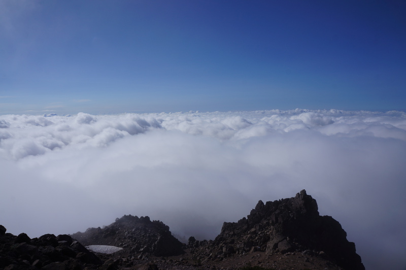
The other hike on my list was Lassen Peak. Lassen Peak is possibly the largest plug dome volcano in the world. Its last activity was May 1914 – May 1917, with its dramatic eruption happening in May 1915. With the eruption being relatively recent, one could say that some of the rocks in the area are California’s youngest rocks. We had to start this hike early as the peak is known for having thunderstorms past noon. The area has been having a bout of cooler than normal weather lately so as we got higher the fog set in and let’s say it was fairly cold. Probably should have had gloves and a beanie. Eventually we made the top rest area and the fog cleared for a few minutes. You could just see Mount Shasta off in the distance. Everywhere else around was cloud. Some snacks and then it was on the way back down. My fingers were going red and hurting cos they were so cold. It was kind of odd later on when they were warming back up because they had a weird sensation.
Today on our last day we went for a drive instead of hiking. First we headed out to Subway Cave which is in the adjoining national forest. The cave is a lava tube formed by lava flowing through lava that had already cooled/hardened. When the flowing lava eventually disappeared a tube like cave was left behind. So with torches in hand into the tube we went. It was only 1/3 long inside it was pitch black and many degrees cooler than outside. There was info boards in the cave that you could read to find out more about the formation. They were easy to find as they’d kindly put reflectors on them.
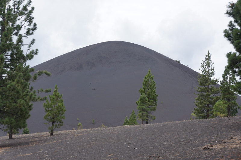
After Subway Cave we went over to the Butte Lake area of the National Park as Cinder Cone was over there. Cinder Cone is another volcano and flow of lava from it created what is known as the Fantastic Lava Beds. We didn’t bother hiking to the top of Cinder Cone as we were all hiked out and had already spent over 2 hours driving already. So instead we hiked part way up the trail to get a better look then headed back.
The next two days are driving days on our way back to LA before we finish of the trip with a few days at Disney.