Mount Rainier National Park
Next National Park on the list is Mount Rainier National Park. The park is located in Washington a bit inland from the Olympic region. After about 6 hours of driving on Wednesday we arrived at Paradise where our accommodation for the next few nights is at the aptly named Paradise Inn. In the US parks systems a number of parks have accommodation inside the actual park and Paradise Inn is one of two in Mount Rainier. So instead of having to tent or RV you can stay in a historic lodge/hotel. They’re often in prime locations and the parks service have done a great job in maintaining them. Staying in one of them is like a look back in time (and a great way to escape the pace of normal life). There’s high open ceilings, a fireplace, a dining room and usually no TV, phones or Internet (or if they do have it the quality is bad).
Welcome to Paradise
Paradise Inn was built back in 1916 and it was restored/renovated back in 2006 to address things like fire safety, seismic structure strength amongst other things. They’ve managed to keep its look and feel though and the very rooms you stay in reflect that of those visitors many years ago would have stayed in. Think tiny room with a small sink in the corner. Each floor has two showers and a male and female restroom. Paradise Inn has the trifecta of no TV, phones or internet. There’s no mobile phone service either. Looking at the old photos up and about, the inn today looks very much like what it did back then. When you look out into the lodge foyer in the afternoon and evening you can see people reading books, playing board games and completing puzzles. Things we would’ve done regularly before the advent of technology. It’s kind of refreshing in a way.
But let’s get back to the park. Mount Rainier NP was the fifth designated National Park in the US parks system and apparently the first that had a master plan. So even the road driving into and through the park had thought and design put into it so that visitors would see views of the mountain as they made their way up. Today it’s roads and buildings are historical landmarks. The park like many others has a number of regions, and driving between them can be time consuming. So some pre-planning of hikes and checking of driving distances is helpful.
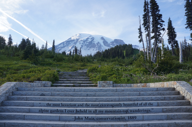
Paradise where we hiked today is an alpine region and in summer once the snow melts it is a hikers heaven as the meadows are filled with a bright abundance of flowers blooming, bees and birds pollinating flowers and lush green alpine vegetation. Luckily for us all the flowers seem to be bloom right now, and the weather outside is blue skies with very little snow on trails and none in the immediate area around the inn. Which is actually not normal. This time of year there is still supposed to be like 6+ feet of snow around Paradise and most of the trails should’ve been snow covered still. Unfortunately the Pacific Northwest had a terrible snow season so the Skyline trail which we hiked was pretty much snow free minus for a few small areas up top.

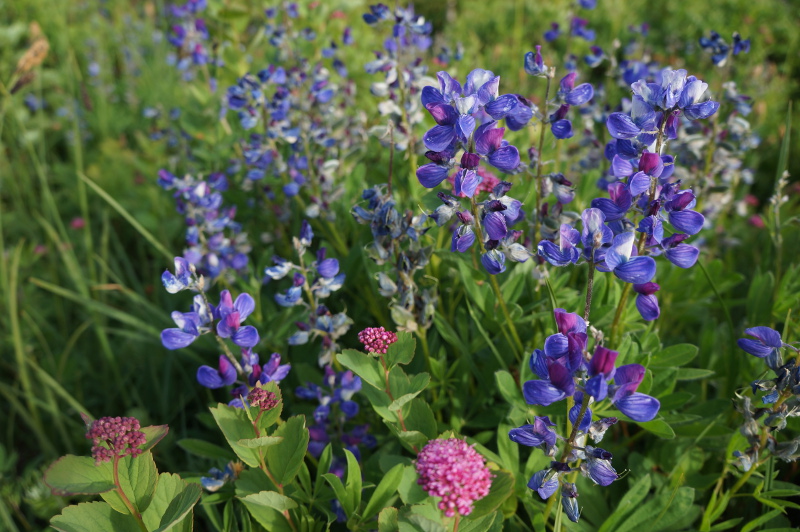
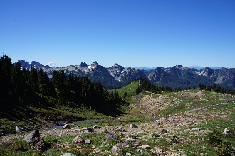
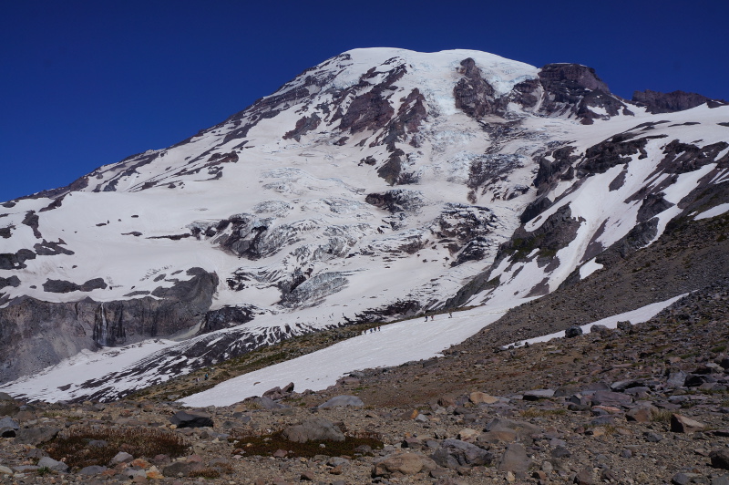
As we’re staying in Paradise, this meant that we could be afforded a chance at sleeping in… except that with the lack of sound proofing and everyone else waking up I still woke up earlier than intended… That’s okay as a peek out the window showed not a cloud in the sky. Today’s hike was only 5.5 miles, considerably short in the scheme of things so we took a few side trails to check out other views. But because it was short it also gave us time to walk leisurely and turn around and take it all in. You ascend up a trail with Rainier looming in front of you, but behind you you’re climbing the valley filled with flowers and the Tatoosh Range in the distance. With the super clear morning weather you could even see Mount St Helens, Mount Hood and Mount Adams in the distance!
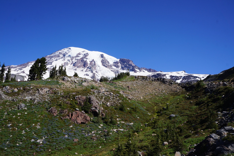
The Skyline Trail is also the trail that the mountain climbers take to get up to Muir Camp, the first stop on their way to attempt an ascent of Mount Rainier. You can actually day hike out to Muir Camp and back if you’re well prepared for changing conditions and can navigate back down if the weather changes – unmarked trail and glaciers to fall off. We were actually quite surprised how close the mountain was to the Skyline trail. Along the way we saw many Hoary Marmots. Marmots are a member of the rodent family and they kind of look like giant guinea pigs to me. They basically spend summer fattening up as in winter they can reduce their heartbeat to 4-5 beats per second and live of their fat stores. The trail has a couple shortcuts that you can take back, but we kept going up to the High Skyline trail the back done. It was interesting to see that the other side of the mountain had a very different look. It was more rocky, and vegetation hadn’t had much of a chance to grow yet. Making it back down, it was time to eat a hot dog. Hot dogs somehow = post hike food for me.
Oh something else cool was they have the nightly astronomy setup at Paradise as well. Excellent for us as all we had to do was wander out of the inn and cross the carpark. Beats having to drive like an hour! Last night we saw Jupiter and 3 of its moons, Saturn (with it’s rings) and a moon, the moon and a pair of stars (which I’ve forgotten the name of). And today the guy had his solar scope out so we got to see the sun. Very cool, especially Saturn and the moon!
Summerland
I’m a sucker for parks with cute or interesting names in trails or areas of the park. It’s often the name that’s caught my attention first. Park names and trails that have caught my attention before: Delicate Arch (Arches NP), Island In The Sky (Canyonlands NP), Road’s End (Kings Canyon NP), Many Glacier (Glacier NP), Exit Glacier (Kenai Fjords NP). Rainer NP got me for a few things: a mountain (volcano actually), it has a trail called the Wonderland Trail. There’s a place called Summerland (not to mention Paradise!). Hook line and sinker, it had me.
So as you can probably guess, today’s hike was out to Summerland. Summerland is about a 8.4 mile return with just over 2000 feet elevation change. The actual trail out to Summerland is part of the Wonderland trail. Wonderland is a 90 something mile trail (96 I think?) that circles Mount Rainier. The overall trail has elevation changes of over 20,000 feet (combined) and about 250 people hike the full loop each year. Many others hike sections hike portions of it. There’s also plenty of day hikes that follow the Wonderland trail for portions of it. The trailhead was on the way to Sunrise (yes another name that may have caught my attention), so we had to get an early start. Sunrise is about 2 hours driving from Paradise so we knew it would take a bit to get there. From what I’d read Summerland is a fairly popular trail in summer but has limited parking so an early start was called for. Funnily enough it isn’t listed in any of the visitor trail maps, which for some reason only list trails starting from the actual visitor centres. But I had my instructions on where it was so we were set.
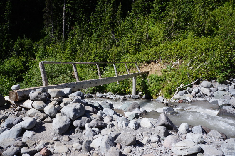
The alarm was set for 6:00AM and we were on the road by 6:30AM. We arrived at the trailhead around 8:00AM, restocked our CamelBaks and hit the trail. The trail was under tree canopy for the majority of the journey uphill. A nice change as it was a lot cooler. The weather is in a bit of a heatwave at the moment so it’s 90+ fahrenheit which is mid 30’s celsius. It’s supposed to be getting close to 100 on Sunday! The trail gradually climbed and we reached a small meadow thing which had flowers which we weren’t sure whether was Summerland (no map). Basically my instructions said something along the line of crossing the creek and then there would be a steep 0.5 mile climb up to Summerland. We had a snack then debated whether we were there or not. The trail seemed to keep going uphill and the first bit didn’t seem particular alpine-ish. The portion after the creek to where we were wasn’t partially steep so the feeling was that it was probably actually 0.5 of a steep climb not 0.5 from the creek. So we started going uphill. Along the way a guy was coming up so we asked him if he knew whether the thing below us was Summerland. He’d done the trail before and he told us nope, Summerland was up all the switchbacks and that it was a huge meadow that was pretty with campsites and a pit toilet. So upwards we kept going. Soon we arrived at Summerland and yep it was a huge meadow. The flowers were in early bloom. July-August is when they really take off. We sat down on a rock for a rest surrounded by the meadow with Rainier in the background. The occasional marmot was scurrying around the place. A cute thing was the marmot we encountered on our way back down. We’d just left the toilet and wanted to take a track down to the main trail but a marmot decided it wanted to dig and play with the rocks on the track. It just sat there, then decided to go lie down on the side of the trail. Then it decided it wanted to eat again, ran up to a flower stalk grabbed it pulled it down and ate it. And ate more flowers. The hike back down was fairly uneventful, just very hot as the temperature had heated up since we left in the morning.

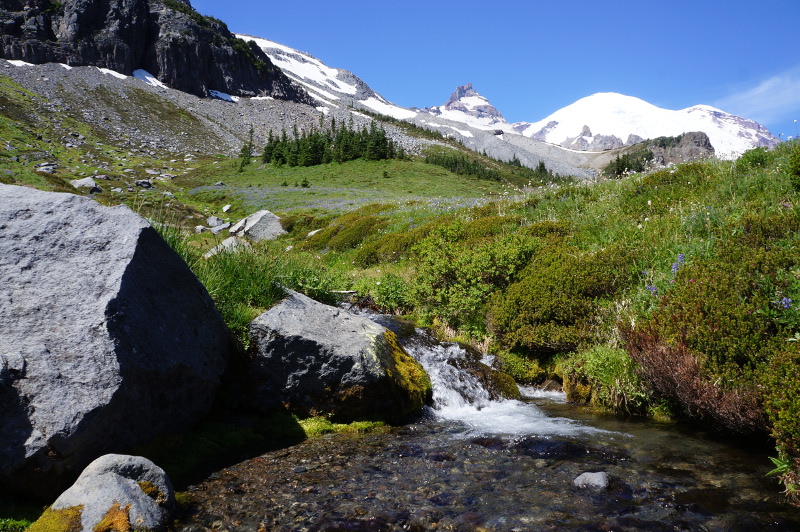
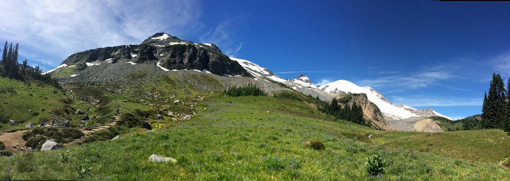
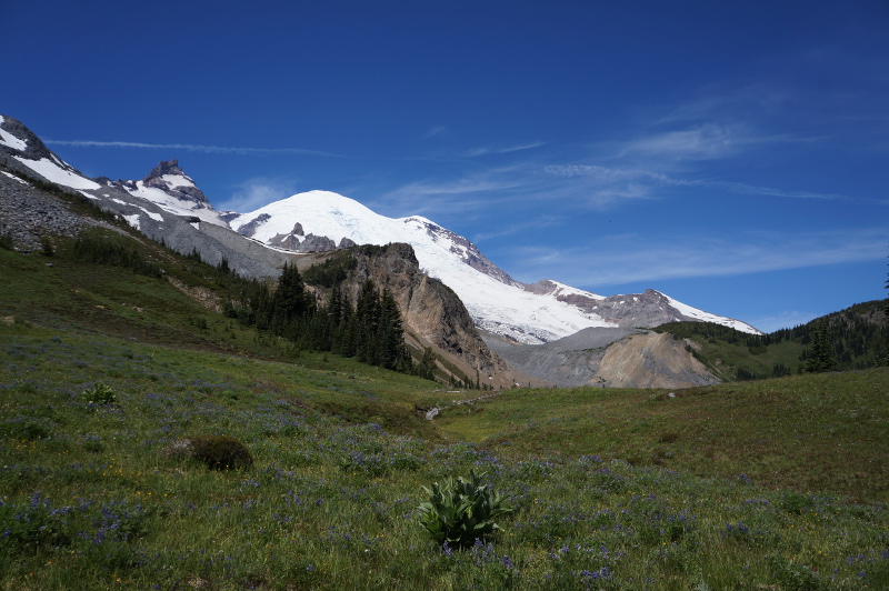
After Summerland we headed over to Sunrise as it wasn’t too far away. Sunrise visitor services and facilities don’t actually open till tomorrow (Saturday) but with the lack of snow season the area is open for hiking now. It’s the highest visitor centre point in the park and the mountain looms in it’s background. We didn’t do any hiking up there as it was super hot but it did offer different views of the park. Then on the way back down we stopped of at Grove of the Patriarchs Trail as it was only a 1.1 mile trail and went though old growth forest. It was an okay trail. It’s probably a trail more catered to day trippers, as you can definitely see the same/similar things in better forms doing a longer trail or visiting parks like Sequoia or the Redwoods. But it did have descriptive boards describing the various trees and how forest ecosystems worked which is great for education.
